
New Tool Aims to Help Forest Owners with Fire Management
New Tool Aims to Help Forest Owners with Fire Management
Beta Version of Southeast FireMap Available for Testing and Comment
FOR IMMEDIATE RELEASE (March 31, 2021)
Greenville, SC – Forest owners and natural resource agencies now have a new tool at their disposal to improve forest health through prescribed burns and by helping manage wildfire risk has been released in its beta version.
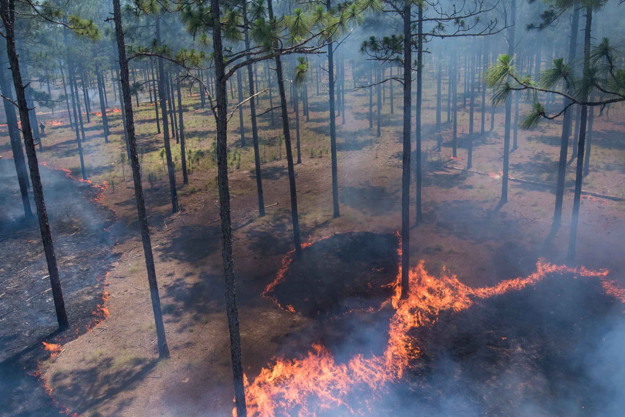
The SE FireMap is the first large-scale attempt to map fire history on private lands, which account for nearly 80 percent of land ownership in the southeast, and provides coverage for public lands as well. This innovative tool uses remote sensing to map all detectable fires over the past two decades and aims to improve future fire management in urban and rural communities. It will track both prescribed fires and wildfires in portions of Virginia, North Carolina, South Carolina, Georgia, Florida, Alabama, Mississippi, Louisiana, and Texas – prioritizing coverage of the historic longleaf pine range.
Through a user-friendly format, this historical data will enable land managers to better target future prescribed burns, helping ensure a more comprehensive, landscape-level approach to forest health.
This beta version of the SE FireMap was developed by Tall Timbers Research, Inc., with support from The Longleaf Alliance and a technical oversight team representing federal and state agencies, non-profit conservation groups, the Longleaf Partnership Council, and the Southeast Partnership for Planning and Sustainability. North Carolina State University helped build the portal that houses the SE FireMap. NRCS provided key funding for the project through an agreement with the U.S. Endowment for Forestry and Communities (Endowment).
“Equipping forest owners with the latest technology to improve forest health will benefit their financial bottom line and provide benefits to society, including reduced wildfire risk,” said Pete Madden, the Endowment’s President and CEO. “We commend NRCS, Tall Timbers, The Longleaf Alliance, and all the partners who contributed to this initial effort. As landowners and partners test and ground-truth the beta version of the Southeast FireMap, an improved tool will emerge that will be available for wider use.”
The SE FireMap version 1.0 is presented as a Google Earth Engine product and data sharing is available for conservation and community planning purposes. To see the mapping products or request data sharing, please visit the Wildland Fire portal at landscapepartnership.org. New users will be required to register on the portal to access the web map.
To provide an optimum user experience for the tool, partners are encouraged to use the SE FireMap and provide feedback on its benefits and limitations. SE FireMap version 2 is anticipated in 2022
The Southern Fire Exchange is hosting an informational webinar April 16, 2021 to give an introduction for this program and give a demonstration. To register, click here.
###
For more information about the SE FireMap, please contact Peter Stangel, Chief Operating Officer 864.233.7646, peter@usendowment.org
The U.S. Endowment for Forestry and Communities (the Endowment) is a not-for-profit public charity working collaboratively with partners in the public and private sectors to advance systemic, transformative, and sustainable change for the health and vitality of the nation’s working forests and forest-reliant communities. www.usendowment.org
